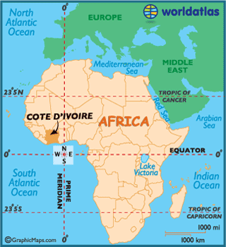
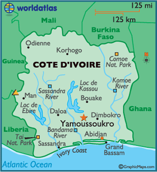
Ivory Coast
Ivory Coast or Côte d'Ivoire,
officially the Republic of Côte d'Ivoire,
is a country in West Africa. It borders the
countries Liberia, Guinea, Mali,
Burkina Faso and Ghana; its southern boundary is along the Gulf of Guinea. The official language is French,
although many of the local languages are widely used. The main religions are
Islam, Christianity (primarily Roman Catholic) and various indigenous religions.
Prior to its colonization by
Europeans, Ivory Coast
was home to several states, including Gyaaman, the Kong Empire, and Baoul¨¦.
There were two Anyi kingdoms, Ind¨¦ni¨¦ and Sanwi, which attempted
to retain their separate identity through the French colonial period and after
independence An 1843¨C1844 treaty made Ivory Coast
a protectorate of France and
in 1893, it became a French colony as part of the European scramble for Africa. Ivory
Coast became independent on 7 August 1960. The
country maintained close political and economic association with its West
African neighbors, while at the same time maintaining close ties to the West,
especially to France.
Through production of coffee and cocoa,
Ivory Coast was an economic
powerhouse during the 1960s and 1970s in West Africa.
However, Ivory Coast
went through an economic crisis in the 1980s, leading to the country's period
of political and social turmoil. The 21st century Ivoirian economy is largely
market-based and relies heavily on agriculture, with smallholder cash crop
production being dominant.